


Voting District 200001, Jefferson County, New York
About
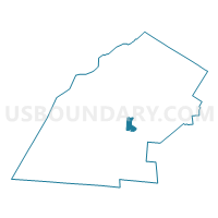
Outline

Summary
| Unique Area Identifier | 627466 |
| Name | Voting District 200001 |
| County | Jefferson County |
| State | New York |
| Area (square miles) | 8.38 |
| Land Area (square miles) | 8.35 |
| Water Area (square miles) | 0.02 |
| % of Land Area | 99.72 |
| % of Water Area | 0.28 |
| Latitude of the Internal Point | 43.96568910 |
| Longtitude of the Internal Point | -75.96323090 |
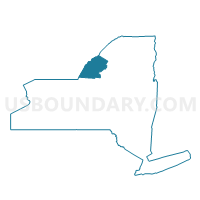
Maps

Graphs
Select a template below for downloading or customizing gragh for Voting District 200001, Jefferson County, New York


Neighbors
Neighoring Voting District (by Name) Neighboring Voting District on the Map
- Voting District 040001, Jefferson County, NY
- Voting District 040002, Jefferson County, NY
- Voting District 100002, Jefferson County, NY
- Voting District 150002, Jefferson County, NY
- Voting District 200002, Jefferson County, NY
- Voting District 200003, Jefferson County, NY
- Voting District 211203, Jefferson County, NY
- Voting District 211204, Jefferson County, NY
- Voting District 211205, Jefferson County, NY
- Voting District 211305, Jefferson County, NY
- Voting District 211503-211505, Jefferson County, NY
Top 10 Neighboring County Subdivision (by Population) Neighboring County Subdivision on the Map
- Watertown city, Jefferson County, NY (27,023)
- Brownville town, Jefferson County, NY (6,263)
- Watertown town, Jefferson County, NY (4,470)
- Hounsfield town, Jefferson County, NY (3,466)
- Pamelia town, Jefferson County, NY (3,160)
Top 10 Neighboring Place (by Population) Neighboring Place on the Map
Top 10 Neighboring Unified School District (by Population) Neighboring Unified School District on the Map
- Watertown City School District, NY (30,934)
- South Jefferson Central School District, NY (11,237)
- General Brown Central School District, NY (8,909)
- Sackets Harbor Central School District, NY (3,207)
Top 10 Neighboring State Legislative District Lower Chamber (by Population) Neighboring State Legislative District Lower Chamber on the Map
Top 10 Neighboring State Legislative District Upper Chamber (by Population) Neighboring State Legislative District Upper Chamber on the Map
Top 10 Neighboring 111th Congressional District (by Population) Neighboring 111th Congressional District on the Map
Top 10 Neighboring Census Tract (by Population) Neighboring Census Tract on the Map
- Census Tract 618, Jefferson County, NY (6,954)
- Census Tract 624, Jefferson County, NY (4,479)
- Census Tract 616, Jefferson County, NY (4,444)
- Census Tract 622, Jefferson County, NY (4,372)
- Census Tract 615, Jefferson County, NY (4,255)
- Census Tract 619, Jefferson County, NY (3,985)